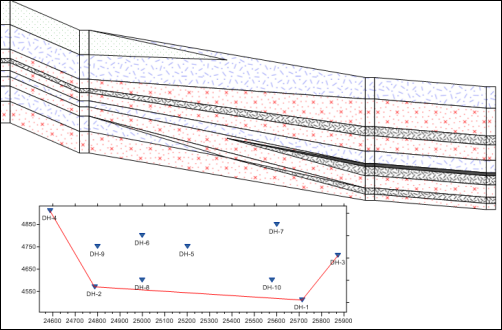
An inserted map view provides location information for the boreholes displayed in a borehole view or cross section view. To insert a map view into a borehole view or cross section view, click the Log | Add | Map View command. If only one map view exists, the map is immediately displayed. If multiple map views exist, select the desired map view from the dialog and click OK. The map is added to the borehole view or the cross section view in the center of the selected pane.

Insert a map view into a cross section, to give the cross section spatial perspective.
To change the map that is displayed in the inserted map, click on the Map View object in the Object Manager. In the Property Manager, click on the name next to Map view name. In the list, select the desired map view to display. The inserted map automatically updates. Click [None] if no map view should be displayed.
The inserted map displays exactly as it appears in the linked map view. To make any changes to the inserted map, select the map view in the View Manager. Make any changes to the appearance of the map and the inserted map automatically updates.
If no map view has been created in the project, the Log | Add | Map View command is not available. Create a map view by clicking the Home | New | Map View command. In the map view, creating a base map or well location map. Then insert the map in the borehole view or cross section view using the Log | Add | Map View command.
See Also