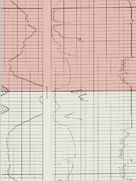
Click the Log | Create Log | Registered Raster command to add a registered raster log. A registered raster log is a scanned image of a paper or electric log with a depth registration file. Layer marks can also be imported with a registered raster log. Registered raster logs can be used in cross sections and modified with the properties in the Property Manager.

Registered raster logs can be added to the borehole
or cross section view and used in analysis.
Registered raster logs are created from a registration file and raster or image file. If the registration file includes only the image file name, the registration file and image file must be in the same file folder or share the same path. Select the registration file in the Open dialog and click Open to create the registered raster log. If the registration file also includes layer marks, a layer mark table can be created. Otherwise layer marks can be added or imported after creating the raster log.
Supported registration file formats include the following:
LIC Petra Log Image Calibration (*.lic)
XML IHS Log Image Calibration (*.xml)
Other data file formats, such as CSV, DAT, TXT, XLSX, etc., can be used as a registration file when the data is formatted as a range table.
See the File Format Chart for a list of supported image/raster formats.
To create a registered raster log:
Click the Log | Create Log | Registered Raster command.
Click in the log pane where you want the registered raster log to appear.
In the Open dialog, click the depth-registration file or range table file and then click Open.
If the log contains multiple sections, select the log section to use in the Log Section dialog and click OK.
In the Log Registration Table dialog, specify a Hole ID and Table name.
Click Save.
If the depth-registration file includes layer marks, select the desired action for the layer marks table in the Layer Marks Table dialog.
Click OK.
The log is displayed in the log pane with the settings from the depth-registration file. A range table is created from the depth-registration file. If the Save layer marks to table option was checked in the Layer Marks Table dialog, a layer marks table is also created. The raster log can be used in cross sections and edited with the raster log properties. If you wish to view the tables, select the table in the Table Manager.
Raster logs are edited by changing properties in the Property Manager. The properties are the same for both registered and unregistered raster log types. To change the appearance and data settings for a raster log, click the log in the Object Manager or borehole view. The properties are displayed in the Property Manager.
The following pages are displayed in the Property Manager.
See Also
Depth Registering a Raster Log