Click the Cross Section | Layer Marks | Import command to import a table that contains the layer marks. Layer marks are the tops or bottoms of the zones or layers that should be connected in the line/symbol plot cross section. The table that the top or bottom values are in should be imported into Strater as a depth or text table type.
Click the Cross Section | Layer Marks | Import command.
In the Import Layer Marks dialog, select the existing table or a new file that contains the layer marks and click Open.
If a new file was selected, step through the import data dialogs to import the data into a new depth type table.
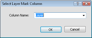
In the Select Layer Mark Column dialog, select the column in the table that contains the layer mark names and click OK.

Select the appropriate column in
the Column Name list and click OK.
Click Yes in the warning that the user modifications will be lost to create the cross section from the imported layer marks.
The layers are connected with lines in the cross section, showing the layer names and locations from the table.
To fill the areas between the layer lines, check the Fill between Layer Lines option in the Layers properties.
See Also