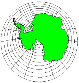
Antarctica
Gnomonic Projection
False Easting: 0
False Northing: 0
Central Longitude: 19.0
Standard Parallel: 2.4
The Gnomonic projection is an azimuthal projection. It is represented as a plane tangent to the globe. At this point of tangency, which is called the standard parallel, all major characteristics are retained. When you move away from the standard parallel in any direction the map is not conformal, not equal-area, and distances are not true to scale. Only areas of less than a hemisphere can be shown and distortion increases noticeably as you move further from the standard parallel.
|
Parameter |
Description |
|
Name |
Specifies the units used in the map. |
|
Scale |
Specifies the unit scale of the projected map, relative to meters. For example, a scale of one means one unit in the projected map equals one meter; a scale of two means two units in the projected map equal one meter; etc. |
|
False Easting |
Specifies the false easting, or horizontal offset, of the projected coordinates, in meters. False Eastings and False Northings are added to the underlying "projected" coordinates as a way to arbitrarily offset their internal XY coordinates after the projection. Unless you have a reason for using these offset values, do not use them. These values do not affect the latitude/longitude coordinates for the map, only the internal coordinates used to plot the map on the screen. If you use False Easting and False Northing offsets for a map, any subsequent boundaries you append to the map must also use these same offsets if you want the imported boundaries to be drawn in the correct relative position to the existing boundaries. |
|
False Northing |
Specifies the false northing, or vertical offset, of the projected coordinates, in meters. See above. |
|
Central Longitude |
Specifies the central longitude of the projection in degrees. The Central Longitude value typically should be defined as the longitudinal center of the map you are going to produce. This value is only significant when you define False Easting and False Northing values, and has no apparent effect on the map. |
|
Standard Parallel |
Specifies the central latitude of the projection in degrees. The Standard Parallel value typically should be defined as the latitudinal center of the map you are going to produce. |
See Also
Map Coordinate Systems Overview
Introduction to Map Projections
Source Coordinate System - Map Layer
Target Coordinate System - Map
Characteristics of Projections