Specify the map layer coordinate system on the Coordinate System page.
Maps can be created from data loaded in a table view or base map files in any coordinate system. The Source Coordinate System is the coordinate system for the collars table data or base map used to create a map layer. A coordinate system normally has a defined projection and datum. If some map layers are using a different source coordinate system than what you want the map to display, the map layer is converted to the map's Target Coordinate System.
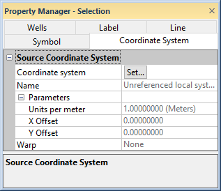
The Coordinate System page is located in the Property Manager when a base or well layer object is selected.
Specify the map layer coordinate system on the Coordinate
System page.
Click the Set button next to Coordinate System to open the Assign Coordinate System dialog. This dialog lets you set the source coordinate system. This is the coordinate system for the original data or base map.
See Also
Map Coordinate System Overview
Introduction to Map Projections